Days 69 to 89
1 September, 2024 – 21 September, 2024
Statistics:
- Distance: 385 km
- Ride time: 31,5 h
- Ascent: 4350 m
- Descent: 4200 m
- Duration: 21 days
- On bikes: 9 days
- Average: 42 km/day
- Distance by car: 750 km
We visited a very small part of the USA, only the state of California—the coastal region south of San Francisco. So I’d say that we’re far from being the USA experts, but we got a small taste of the country. The first thing we experienced was Customs and Border Protection (CBP), and we got a first-hand experience that getting into the USA is not the easiest thing in the world, even as the citizens of the European Union. We had the honor of being escorted to the second-check area, where we could see what a lot of people from Asia, Africa, or the Middle East had to go through.
But we quickly forgot about that bad experience, because on our second day, we were already tourists in San Francisco. We stayed in Foster City, and there is a very convenient CalTrain that will take you to the center of SF while also allowing you to take your bike with you without extra fee. While visiting the city, the coastal part is very beautiful: wide sidewalks, views of Oakland Bay Bridge and Golden Gate Bridge, Fisherman’s Wharf, and seeing tall skyscrapers in the center of the city. The city itself is full of steep streets; you either push uphill or you burn your breaks going downhill, and the center wasn’t nearly as nice as the north-east coast of the city. It was shocking to see the driverless Waymo cars going around San Francisco, and we would love to take a ride in one of them someday. Also, if we went to the city one more time, we would probably spend more time seeing nature parks; there are a few big ones in there.
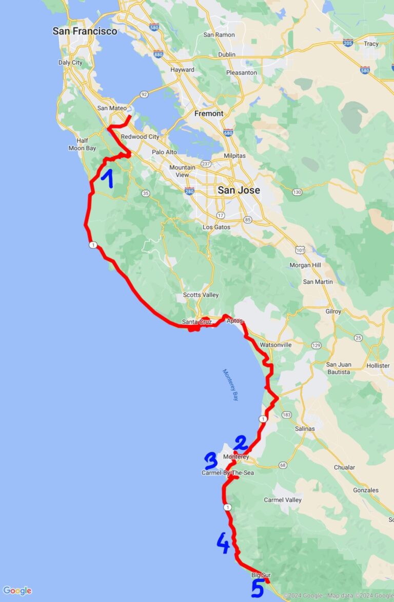
Going south from San Francisco, there is Highway 1 that goes right next to the coast all the way down to San Diego and is the most common route to take if you want to cycle south. It has a wide shoulder almost all the time, so it’s very bike-friendly. Because of the high number of bicycle tourers that ride here, the state of California started to introduce Hiker/Biker camps in most of its state parks along the way. The idea of these camps is to offer a place to sleep for cheap, usually costing between 0$ and 10$ per person per night, providing only the basic utilities, like toilets and showers. It’s mandatory to arrive in the park by bicycle or on foot, and most of them have a maximum stay of 1 to 3 nights. We used the website https://gobikecamping.com/, which has listed over 500 hiker/biker camps all over the United States, not only in California. You can also read more about these camps on the website. We really hope that something like this will come to Europe; currently most camps there don’t have any discounts for bikers, and they would cost us over 30€ per night, providing us with a big lot, water, and electricity that we don’t need.
You know what’s also better here than in Europe? You understand everyone if you speak English; there is no new language every few weeks of riding. Therefore, it’s much easier asking someone for help or just having casual conversation with strangers on the street.
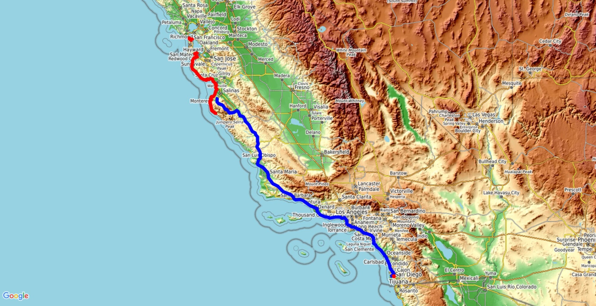
If you checked the map on top of the blog page, you might have seen that there is a blue line on there. Well, our initial plan was to cycle all the way down to San Diego, but on the way, we had some doubts about going to Mexico. We had a non-extendable 90-day visa for the USA, so we decided to rent a car in Monterey and drive past Los Angeles to San Diego so that we could cross into Mexico as soon as possible. Then we would have enough time to get a feel of the country and decide if we want to continue or if we go back to the USA (on the same visa) and fly out from there. What also contributed to our decision was the fact that Los Angeles is a HUGE city that would take us several days to pass with bikes, and there aren’t any campsites on the way. We would probably need to pay for hotels or hostels along the way, which could easily surpass the cost of just renting a car and paying for gas. I suppose that cyclists, who do more daily millage than we do, have fewer problems with crossing the LA.
Since we arrived from 40°C weather in Europe, California seemed cold to us. The weather here is mild because of the proximity of the ocean; it’s never really hot, you often have foggy weather, and the wind feels chilly and fresh. It’s much easier to cycle in such weather, and there almost isn’t any rain; the only thing we disliked was fog close to the ocean. Our tent would get wet every night, and we missed a lot of ocean views going down to Big Sur because it was really foggy weather. Also, be cautious about the sun; it’s much stronger than you feel it on your skin. It’s very easy to get sunburnt because of the colder air.
Going south from San Francisco, there are quite a few places worth stopping by:
- Tunitas Creek and Bike Hut: if you climb from Woodside on Kings Mountain Road and cross Skyline Road, there is a beautiful Tunitas Creek road, which joins Highway 1 by the coast. This way you avoid the highway, and there is hardly any traffic. The whole area is covered with high redwood trees, so you ride in the shadow, and you get a feeling of being in a very remote place. Before the end of the road, there is a small red bike hut on the right—a place where you can stop, refill water, buy some coffee or snacks, and they have some basic tools for the bikes. It operates based on trust; there is nobody there to check if you really paid; it’s a beautiful concept.
- Monterey Bay Aquarium: a huge aquarium with many different sea animals, from sea otters, birds, and penguins to crabs, sea stars, jellyfish, and a ton of different fish. It’s very easy to spend the whole day in there, just walking around the aquarium, seeing feeding of different animals, or listening to some interesting presentations about the sea life in their auditorium. The entrance fee is not the cheapest, at 50€ per person, and food inside is very expensive; make sure to have a big breakfast before. But it’s an amazing experience, and the best thing is that there is a pool where you can touch and pet different mantarays!
- 17-mile drive: On the coast of Monterey, there is a beautiful bike road around the peninsula. You can see a lot of sea life on the way; we saw birds and even sea lions just lying on the beach and rolling over each other.
- Big Sur: this part of the California coast is supposedly one of the prettiest, with a lot of bridges and steep cliffs, the most famous one being Bixby Bridge. It’s a famous postcard picture of California, almost comparable to Golden Gate Bridge. We were unfortunate that south of Big Sur was a landslide that blocked the road completely, and we had to go back north to Monterey, and the weather we had going both ways was foggy and rainy, so we didn’t see much of the beautiful views, but people say that they’re there. Note: in recent years there were a lot of landslides in that area, it’s worth checking the situation before you go there.
- Pfeiffer State Park: this beautiful park offers hiker/biker camping, where you sleep under huge redwood trees. The River Gorge there is worth a visit, especially if it isn’t packed with tourists.
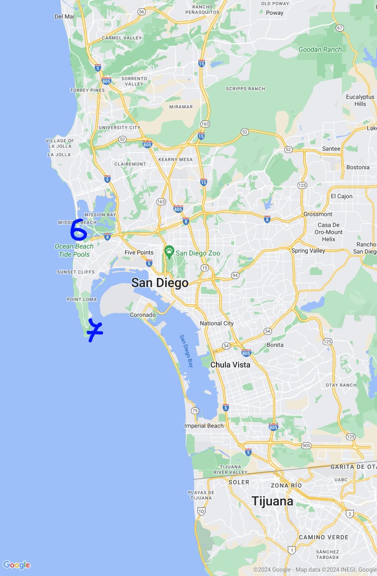
- San Diego Ocean Beach: Andrew took us there, and it’s a part of the city with a special energy, still having some hippie vibe in there. A lot of small shops with a bunch of cool things; we loved the sticker selection that they have.
- San Diego Cabrillo National Monument Park: a viewpoint over San Diego, a park is dedicated to Juan Rodriguez Cabrillo, a conqueror of this part of today’s California. A part of Highway 1 is named after him (Cabrillo Highway). It’s an interesting way to learn some history.
Riding on the highway can quickly become boring, the traffic can be heavy at peak hours, and it’s very hard to sleep anywhere beside the official campsites. Most of the property next to the highway is fenced away, and even if it wasn’t, there aren’t almost any suitable spots. It’s mostly hills covered with small bushes, and you can’t put your tent on that. Also, all beaches that we passed had a big sign that it’s forbidden to sleep or camp there and that they close at sunset. One night we even had to set up a tent 2 meters away from the highway on a wide gravel shoulder, next to an RV that was already parked there, because we couldn’t find any better spot.
Speaking of beaches, the ocean water is cold. Like really cold. And there was a lot of kelp and seagrass floating on top or being washed on the beach. We’re ashamed to admit, but because of the cold weather and cold water combination, we didn’t go for a swim in the ocean for the full 20 days that we spent in California.
None of the cities that we crossed on the way were specifically bike friendly; there weren’t any bike lanes, and the road intersections can easily get confusing. It’s very common here that there aren’t any traffic lights at the intersections and that all of the roads have a stop sign. If that’s the case, there are a couple of rules that you should follow:
- First comes, first goes. If everyone has stop signs, the one who got first to their stop sign has the right to go through the intersection first.
- If two cars arrive at their stop signs simultaneously, the one on the right is the first to go, or the one not turning left if they’re head-to-head (normal traffic rules).
- Is the intersection busy? Then the road with the most cars in line usually goes first. Everyone else waits a little bit.
- Do you feel especially generous? You can always wave to someone else to go first. It seems that that’s the polite thing to do while confusing everyone else.
- If you’re in a hurry, just be very determined to go first; everyone else will probably stop.
Now imagine being on a bike; where do you fit in these rules? Well, it depends on the car drivers. Some of them will give you the right to go first, regardless of the situation. Other drivers will not consider you part of the traffic and will go as if you’re not there. And usually, you’ll be considered a regular vehicle, so you just follow the rules above. But it has happened to us before that we stopped; a couple of cars went through the intersection just ignoring us, and then you get a polite driver who waits for you while everyone else waits for the polite driver. Then we all wait and look at each other.
If you managed to ride your bike through the city and all those intersections, you might arrive at the grocery store. First of all, all prices in the store are with no tax included. So don’t even try to calculate in your head how much you will pay; you’ll be wrong. The amount of tax depends on the US state and on the category of what you’re buying. And what are the prices like, compared to the European ones? Most of the groceries are more expensive; the only exception that we found was going to Costco and buying things in huge packaging; then you come to comparable prices. However, the gas prices are significantly lower than those in Europe, typically around 0.90€ per liter.
All in all, California was probably the easiest part of our cycling journey. So many people do this part of the Pan-American Highway; you have a lot of blog posts about it, and especially hiker/biker camps are a blessing. There are a lot of WarmShower hosts along the way, and people that you meet are often times more than happy to help you anyway they can.
We would love to come back into the USA later and explore it a bit more. Our wish was to visit Sequoia National Park, but cycling over the Central Valley wasn’t something that we really desired, so we might come in the future with backpacks, rent a car, and go hiking there for a couple of days. There is still so much to see just in California, and even more in the whole USA, that it would be a shame not to come back one day. Hopefully, in a not-so-distant future.


